There are hundreds of historic houses in Sandwich. The Sandwich Historical Commission works with the Massachusetts Historical Commission to document information about historic properties, districts, and landmarks which is subsequently made available to the public via a database called the Massachusetts Cultural Resource Information System, better known by its acronym MACRIS.
An excellent article about MACRIS and the Sandwich Historical Commission’s work with MACRIS is available here.
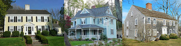
To get a taste for the type of information that MACRIS holds, we recommend taking a look at the MACRIS files for these two Sandwich properties–
If you would like to research the history of your own home here’s how to get started.
1. Become familiar with MACRIS
You don’t want to reinvent the wheel, so first see what information is already available in MACRIS. Once you open the site, scroll to the bottom and accept the terms and conditions.
The main page will then open. You will see a variety of search options on the left side. We recommend that you enter Sandwich–don’t forget to hit “Apply”–and then enter the street address and hit “Apply” again.
If there is a .pdf link on the right side, the property has been inventoried. Open it to see what details are already documented. The amount of detail can vary widely.
Another option is to explore MACRIS by area. Sandwich is divided into the following areas (SDW is shorthand for Sandwich); just enter the five-character area designation as the search criteria (see the last search option and enter, for example, SDW.C).
SDW.A – Sandwich Center Village Sandwich
SDW.B – Sandwich Center – East Sandwich
SDW.C – Jarvesville Sandwich
SDW.D – Main Street – Charles Street Area Sandwich
SDW.E – Route 6A – Sandwich Village Bypass Area Sandwich
SDW.F – Shawme Road Area Sandwich
SDW.G – Route 6A – West Area Sandwich
SDW.H – Town Neck Sandwich
SDW.I – Main Street – Route 130 Area Sandwich
SDW.J – Forestdale Sandwich
SDW.K – South Sandwich Sandwich
SDW.L – Spring Hill Sandwich
SDW.M – Route 6A Area Sandwich
SDW.N – Route 6A East – Scorton Marsh Sandwich
SDW.O – Old County Road Area
SDW.P – Crow Farm Sandwich
SDW.Q – Sandwich Fish Hatchery Sandwich
SDW.R – Old King’s Highway Regional Historic District Sandwich
SDW.S – Town Hall Square Historic District Sandwich
SDW.T – Camp Edwards – Cantonment Blocks 12 and 13 Sandwich
SDW.U – Otis Air Force Base – BOMARC Missle Facility Sandwich
SDW.V – Camp Edwards Firing Ranges Sandwich
SDW.W – Jarvesville Historic District Sandwich
SDW.X- Town Hall Square Historic District Sandwich
SDW.Y – Spring Hill Historic District
There are PDF files for each area. They will tell you which area your house is in and may also offer further details about your home.
2. Visit MACRIS Maps
You can also use the Maps section of MACRIS to obtain information. As described by Sandwich archivist Jen Ratliff, “This tool is especially valuable when records for a specific property are incomplete or missing, as it enables users to explore neighboring parcels that may have once been part of the same property and could be better documented.”
3. Visit the Sandwich Town Archives
The Sandwich Town Archives are filled with information that can help you research your historic home. An overview of the materials available and a guide to visiting the Archives is available here. The Archives are located within the Sandwich Public Library at 142 Main Street.
Here are a few pointers for researching your historic home with information available in the Archives.
- The Property Asset Files are a good place to start your house history search. There is a folder for each historic property that typically documents the location, physical appearance, condition, some history, and a photograph of the property. These files are the basis for the information which is also accessible digitally through MACRIS (Massachusetts Cultural Resource Information System).
- If you’re researching a property by an early owner’s name, the Family Files may have helpful information. For example, if you know a house was owned by Jane Smith, you could request the Smith file to see what is on file about Jane and, perhaps, her house.
- There are several particularly good maps that list the names of owners from days gone by, including the Walling maps for 1857 and 1858 as well as the Sandwich pages from Walker’s 1880 Atlas of Barnstable County. These maps are also available on our website here.
- Tax records from the Office of the Assessor can often be a great help in researching who owned a home and when. Records are available for the periods 1783-1860 and 1903-1945, but be aware that there are some gaps.
- Census records can also be helpful if you’re researching by name. Only the names of the “head of household”are available in the censuses for 1820, 1830, and 1840; all family members are listed in the censuses for 1850, 1855, 1860, 1870, 1880, 1900, and 1910. Many census records are also available online through ancestry.com and other genealogy sites.
- Books about the region’s history can also be helpful. One standout resource is local historian Russell Lovell’s Sandwich, A Cape Cod Town. There you may find information about the early inhabitants of your home as well as bits of history that may have taken place in your neighborhood—even on your street. Other worthwhile books about Sandwich include:
-
-
- Barlow, Raymond E. & Kaiser, Joan E., The Glass Industry in Sandwich, Vol. 1-5. Windham, NH: Kaiser Publishing Company, Inc., 1989-1993.
- Cullity, Rosanna & Cullity, John Nye, A Sandwich Album, Sandwich, MA: The Nye Family of America Association, Inc., 1987.
- Vuilleumier, Marion R., Scenes of America Sandwich Cape Cod’s Oldest Town. Portsmouth, NH: Arcadia Publishing, 2006.
-
4. Area Churches Also Have Archives
First Church of Christ, United Church of Christ
Historical records 1730-1975
Access by permission of church staff (508-888-0434).
Church records included: Calvinistic Congregational Society, the Pilgrim Church, the Sandwich Federated Church, the Methodist Episcopal Church, the Congregational Church, the Unitarian Congregation, First Parish Church, and the First Church of Christ.
Examples:
- Records of baptisms, weddings, funerals; Sandwich Federated Church, 1944-1969
- Alphabetical index of church members 1886-1970s; compiled by Barbara Gill
- Church record, Methodist Episcopal Church, 1796-1874; history of church, membership, marriage, baptismal records
- First Church Records, 1640-1954 ; marriage baptisms, membership, list of pastors
A complete Index is in the Sandwich Finding Aids notebook. The Index is labeled “First Church records.”
Corpus Christi Parish
Historical records, 1845- date. Access by permission of the parish staff (508-888-0209).
Collection consists of 31 volumes of records of marriages, deaths, baptisms, confirmations and First Communions, from 1845 on. Also includes an incomplete cemetery register and copy of a cemetery book from 1890
A complete Index is in the Sandwich Finding Aids notebook. The Index is labeled
“Corpus Christi Parish.”
St. John’s Episcopal Church
Historical records, 1854-1968. Access by permission of church staff (508-888-2828).
Annual meeting records and records of membership, marriage, baptisms and deaths. Also includes correspondence, receipts and deeds pertaining to the building and its construction in 1899.
A complete index is in the Sandwich Finding Aids notebook. The Index is labeled “St Johns Episcopal Church.”
5. The Registry of Deeds
6. Town Assessor’s Database
Assessor’s website: https://sandwichmass.org/mapping.asp
1. Assesors’s Number: This is the Parcel ID. Obtain from the Town Assessor’s Website: https://sandwichmass.org/mapping.asp
Enter Street name then House Number, Click Property Search. Map ID and Parcel ID will appear. On the above example, 73 is the Map ID, 116 is the Parcel ID. (Don’t close the window for this website; we will be using it again later.)
3. Area: arch.
Whew! you’re done.
Now consider obtaining a historic marker to commemorate all of that interesting research!

